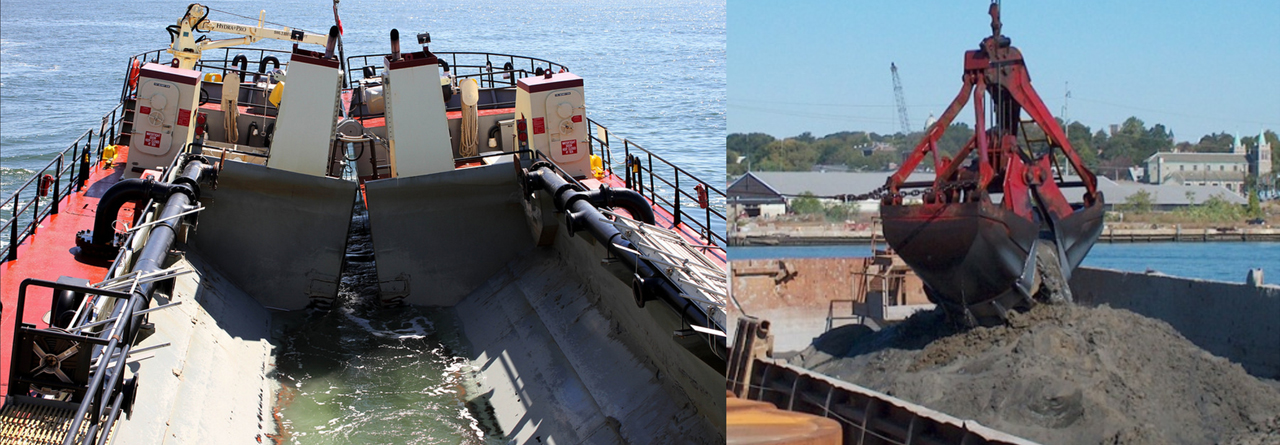
Description: Maintenance responsibility for more than 25,000 miles of navigation channels and 400 ports and harbors throughout the United States requires extensive surveying and mapping services, including boundary, topographic, hydrographic, terrestrial lidar, and multispectral and hyperspectral aerial imagery collection as well as airborne topographic and bathymetric lidar acquisition, project-level GIS implementation, development of file-based geodatabases, and GIS tool development.
Three representative survey and mapping datasets include the National Channel Framework (NCF)—an enterprise geodatabase of information on all 61 USACE-maintained high-tonnage channels —hydrographic surveys, which provide assistance in locating navigable channels, determining dredging requirements, verifying dredging accuracy, and maintaining harbors and rivers —and Inland Electronic Navigational Charts(IENC), accurate navigational charts provided in a highly structured data format for use in navigation systems and to increase overall navigational safety.
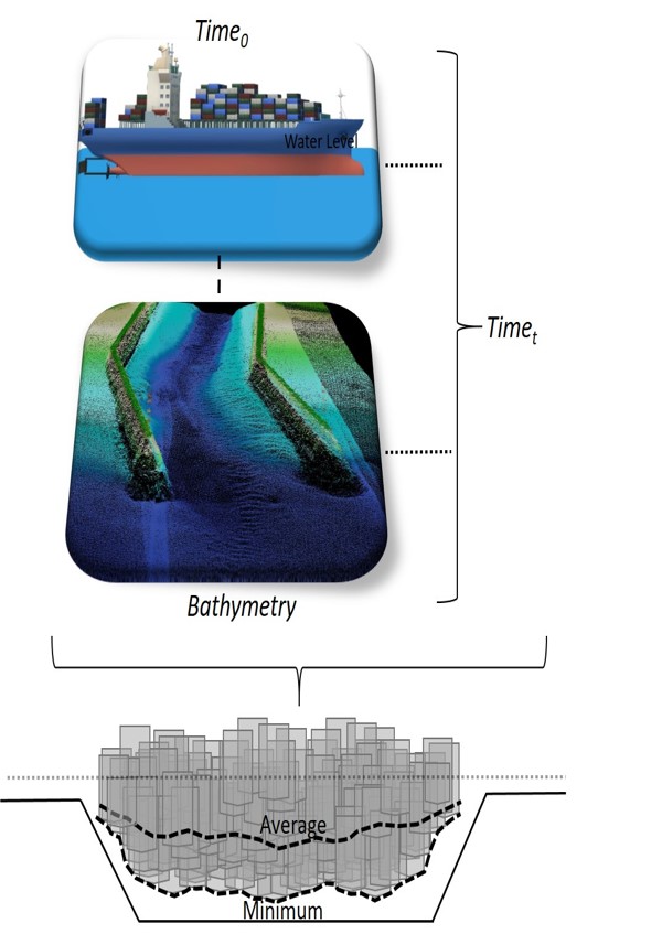
Description: This work employs enterprise datasets to create three-dimensional geospatial layers in order to support objective evaluations of navigation channel functional condition. The availability of time-stamped vessel position reports, broadcast as frequently as every 6 seconds via onboard Automatic Identification System (AIS) transceivers, allows for the vessel dimensions (length, beam, and draft) to be projected for direct, three-dimensional comparisons against the hydrographic surveys of the maintained navigation channel. Recent efforts to use historical hydrographic surveys to determine localized shoaling rates are leveraged to identify shoalest points and other “hot spot” areas of concern relative to the dimensions, positioning within the channel, and transit frequency of calling vessels. After adjusting for tides, the AIS-derived vessel traffic distributions, represented by probabilistic surfaces, are combined with the bathymetric survey data to determine limiting depths along the channel. The goal is to objectively and consistently quantify the relative effectiveness of maintained channel dimensions in supporting the Navigation mission requirement for safe, reliable, and cost-effective marine transportation.
Read Abstract
Abstract: The U.S. Army Corps of Engineers maintains hundreds of deep-draft coastal ports and waterways as part of its Navigation mission, which is vital for sustaining maritime commerce and national security. These dredged channels are presently evaluated during the annual Operations and Maintenance budget formulation process in terms of the relative value to the Nation, and this value is weighed against the costs of the regular maintenance dredging required to keep the channels at sufficient depths and widths to enable cost-effective marine transportation. In order to maximize the transportation benefits that can be realized from limited dredging dollars, objective and straightforward methods are needed to evaluate channels and prioritize maintenance dredging work packages. This work employs enterprise datasets to create three-dimensional geospatial layers in order to support objective evaluations of navigation channel functional condition. The availability of time-stamped vessel position reports, broadcast as frequently as every 6 seconds via onboard Automatic Identification System (AIS) transceivers, allows for the vessel dimensions (length, beam, and draft) to be projected for direct, three-dimensional comparisons against the hydrographic surveys of the maintained navigation channel. Recent efforts to use historical hydrographic surveys to determine localized shoaling rates are leveraged to identify shoalest points and other “hot spot” areas of concern relative to the dimensions, positioning within the channel, and transit frequency of calling vessels. After adjusting for tides, the AIS-derived vessel traffic distributions, represented by probabilistic surfaces, are combined with the bathymetric survey data to determine limiting depths along the channel. The goal is to objectively and consistently quantify the relative effectiveness of maintained channel dimensions in supporting the Navigation mission requirement for safe, reliable, and cost-effective marine transportation.